City-Wide Urban Heat Monitoring Across Leeds Treescapes
Leeds, United Kingdom
 Photo: © Jim Parker / Leeds Beckett University
In partnership with

Leeds Beckett University
Leeds, United Kingdom
The Challenge: Urban Heat Needs Street-Level Evidence
Cities run hotter than the land around them, and the health cost of that heat falls hardest on the most vulnerable. Green infrastructure is one of the most effective ways a city can take the edge off that heat — but planners deciding where to protect or expand tree cover need local evidence, and modelled climate data or regional weather averages cannot show which streets, parks and woodlands actually keep people cool. Leeds City Council's planning policy sets out an aspiration to double the city's tree cover to over 30% by 2050, and decisions of that scale need real measurements from the city itself.
The Deployment: 65 Sensing Points Across One City
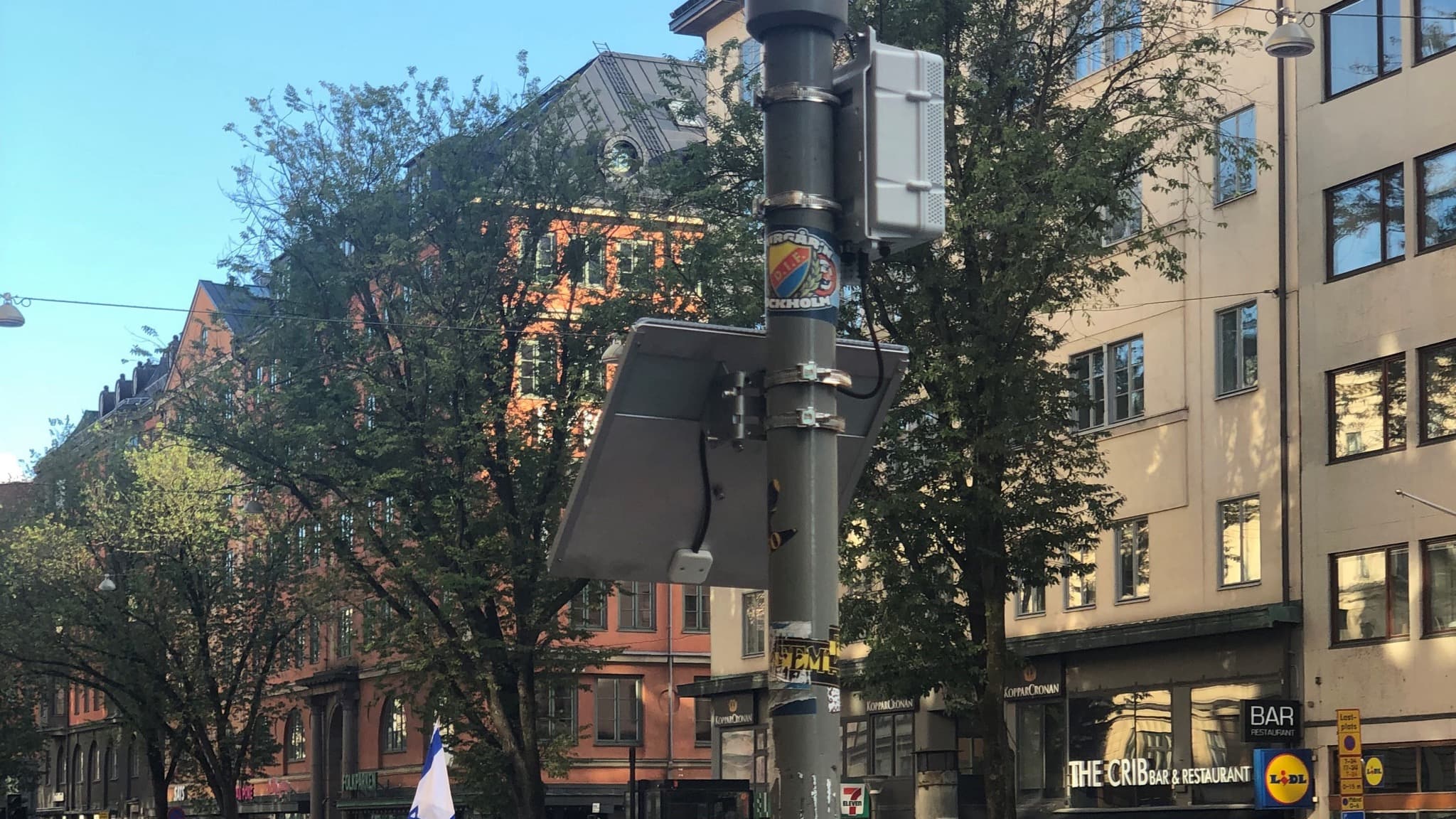
Bespoke sensors were developed for the network as a joint venture between the lead author at Leeds Beckett University and Sensorbee. Each unit is wireless and battery powered, sends its data over the GSM mobile network, and records air temperature (±0.2°C) and relative humidity (±1.8%) every 15 minutes, with an integrated Stevenson screen shielding the sensors from direct sunlight — so units could be installed anywhere in the urban environment without power or data cabling. The team installed 65 units across Leeds at a height of 2.5–3 m: 35 in built-up grey spaces, fixed to street-light and road-sign poles, and 30 in green spaces, hung from branches — four in small urban parks, eight in larger parks, three in allotments and urban farms, and 15 in larger treescapes. Full monitoring began in April 2023, the network remains in operation, and the published analysis covers the summers of 2023 and 2024. The work was funded through the Future of UK Treescapes programme.
The Results: Trees Measurably Cool the City
Two summers of data turned a long-held assumption into published, peer-reviewed evidence. The study — "Comfort in the canopy: How urban treescapes affect human thermal comfort in a temperate climate" — was led by James Parker at Leeds Beckett University with Catherine E. Scott, James B. McQuaid and Thomas J. Sloan at the University of Leeds, and published open access in the British Ecological Society journal People and Nature in 2026 (DOI: 10.1002/pan3.70292). The team used the Universal Thermal Climate Index (UTCI) to translate raw temperature and humidity into the heat stress a person would actually feel at each location.
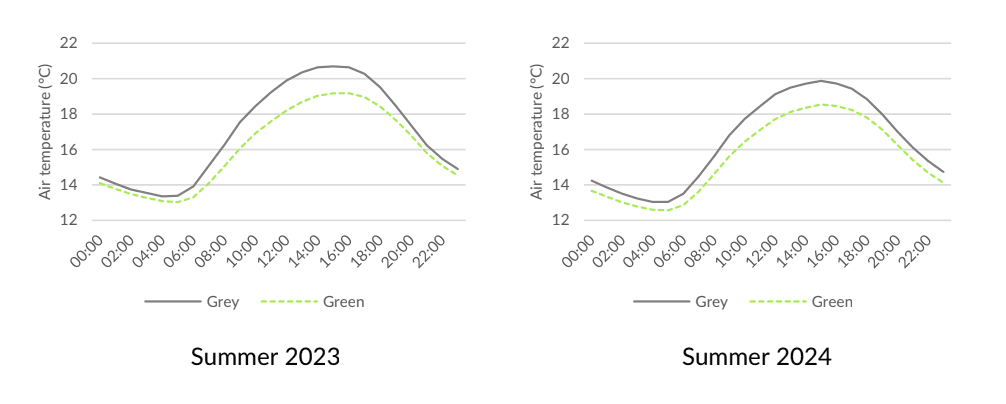
Cooler under the canopy: Urban treescapes were the coolest places in the city — on average 1.4°C cooler than the surrounding grey spaces (versus 0.7°C for parks), and up to 5°C cooler at peak times.
Far less heat stress: Accounting for the solar radiation that actually reaches a person under the trees, treescapes exposed people to 96% fewer hours of strong heat stress and 64% fewer hours of moderate heat stress.
Below the health threshold: The local heat-mortality threshold for Leeds (22.2°C) was exceeded 63% less often under the tree canopy than in grey urban spaces.
What It Means for Cities
Dense, long-running sensor networks turn planning hypotheses into evidence a city can act on. The Leeds findings directly support the case for retaining and expanding urban tree cover, and the measurements will keep working: the network feeds Sensing Leeds, a partnership between Leeds Beckett University and the University of Leeds, supported by Leeds City Council, that makes historical and live environmental data openly available through a GIS web portal. A beta version launched in October 2025. For any city weighing green infrastructure decisions, this is what neighbourhood-scale measurement makes possible.
Source
Parker, J., Scott, C. E., McQuaid, J. B., & Sloan, T. J. (2026). Comfort in the canopy: How urban treescapes affect human thermal comfort in a temperate climate. People and Nature. Published by John Wiley & Sons Ltd on behalf of the British Ecological Society.
DOI: https://doi.org/10.1002/pan3.70292
Open access under a Creative Commons Attribution 4.0 (CC BY 4.0) licence. The figure reproduced on this page is taken from the paper under the same licence. View licence
Read the full study (open access)