
Posted by David Löwenbrand on · 6 min read
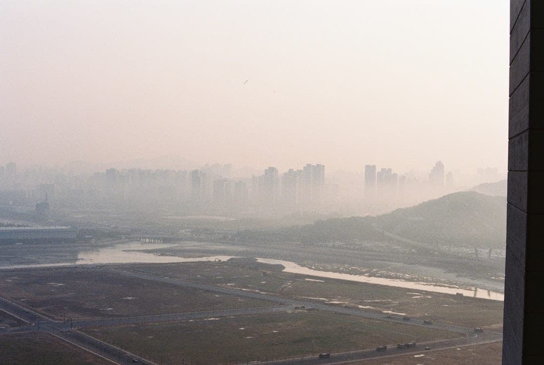
Air pollution kills over 6.7 million people per year, according to the World Health Organization. In 2025, the World Health Assembly approved a roadmap to cut air pollution-related deaths by 50% before 2040. Achieving that target requires something most countries still lack: dense, localised air quality data collected continuously and made available in real time.
The WHO's 2021 updated Air Quality Guidelines set annual mean PM2.5 at 5 µg/m³ (tightened from 10 µg/m³ in the previous 2005 guidelines), NO₂ at 10 µg/m³ (down from 40 µg/m³), and introduced interim targets acknowledging that most countries cannot achieve the final guideline values immediately. Most cities exceed even the interim targets by two to ten times. Closing the gap between policy targets and ground-level reality depends on monitoring infrastructure that is affordable, scalable, and capable of operating without mains power or fixed network connections.
Why National Networks Fall Short
Government-run reference monitoring stations provide laboratory-grade accuracy, but they are expensive to build and maintain. A single reference station typically costs EUR 150,000 to EUR 300,000 to install and EUR 18,000 to EUR 36,000 per year to operate, requiring climate-controlled housing, mains electricity, calibration gases, and regular manual servicing. As a result, most countries operate only a handful of stations, often concentrated in capital cities.
This creates large blind spots. Industrial zones, residential areas near transport corridors, and peri-urban communities frequently go unmonitored. When pollution events occur in these locations, there is no data to trigger a response. Without local measurements, health impacts accumulate silently while policymakers rely on modelled estimates rather than direct observation.
The WHO roadmap explicitly calls for expanded monitoring coverage in low- and middle-income countries, where fewer than 10% of cities have any air quality monitoring at all. Meeting this goal with reference-grade equipment alone would cost billions and take decades to deploy.
What the WHO Roadmap Requires From Monitoring
The roadmap identifies several capabilities that monitoring systems must deliver to support its targets:
- ·Spatial density: Enough monitoring points to capture pollution variation across neighbourhoods, not just city averages
- ·Temporal resolution: Continuous data at hourly or sub-hourly intervals, not periodic manual samples
- ·Multi-parameter coverage: Simultaneous measurement of PM2.5, PM10, NO₂, O₃, CO, SO₂, and other pollutants
- ·Accessibility: Data available to authorities, researchers, and the public in near real time
- ·Sustainability: Systems that operate long-term without prohibitive running costs
Traditional monitoring approaches satisfy some of these requirements but fail on cost and scalability. Indicative-grade sensor networks fill the gap by delivering continuous, multi-parameter data at a fraction of the cost per monitoring point.
How Distributed Sensor Networks Bridge the Gap
Distributed monitoring uses multiple compact, autonomous sensor stations deployed across a city or region. Each station measures several pollutants simultaneously and transmits data wirelessly to a cloud platform. This approach addresses the WHO roadmap requirements directly.
A single Sensorbee Air Pro 2 station measures PM1, PM2.5, PM10, NO₂, O₃, CO, SO₂, temperature, humidity, and atmospheric pressure. It operates on solar power with battery backup, connects via LTE-M or NB-IoT cellular networks, and installs in under 10 minutes without electrical infrastructure or specialist tools.
Deploying 20 to 50 of these stations across a city costs less than a single reference station while providing spatial resolution that no reference network can match. Each station streams data to Sensorbee Cloud, where it is available for dashboards, alerts, historical analysis, and integration with third-party platforms via API.
Measuring Pollutants That Matter Most
The WHO guidelines focus on six pollutants with the strongest evidence of health harm. Effective monitoring must cover all of them.
Particulate matter (PM2.5 and PM10) causes the greatest health burden globally. Fine particles below 2.5 micrometres penetrate deep into the lungs and enter the bloodstream. The WHO guideline of 5 µg/m³ annual mean is exceeded in over 90% of the world's cities. The Sensorbee particle matter module uses laser scattering to measure PM1, PM2.5, and PM10 concentrations continuously.
Nitrogen dioxide (NO₂) comes primarily from traffic and combustion. The WHO guideline is 10 µg/m³ annual mean. Urban areas with heavy traffic routinely record 30 to 60 µg/m³. The NO₂ sensor module provides continuous roadside and urban background measurements.
Ozone (O₃) forms when sunlight reacts with NO₂ and volatile organic compounds. Peak concentrations during summer heatwaves can exceed 180 µg/m³ in European cities, well above the WHO guideline of 100 µg/m³ peak season mean.
Sulphur dioxide (SO₂) and carbon monoxide (CO) remain concerns near industrial facilities and in cities with older heating systems. Dedicated SO₂ and CO sensor modules slot into the Air Pro 2 platform for site-specific deployment.
From Data to Public Health Action
Collecting data is necessary but not sufficient. The WHO roadmap emphasises that monitoring must lead to action. Three practical applications show how real-time data translates into health outcomes.
Source identification. When PM2.5 spikes at specific times and locations, the data reveals patterns linked to traffic peaks, industrial operations, or agricultural burning. Overlay with wind sensor data from the same station pinpoints upwind sources. Authorities can then target interventions at the actual emission source rather than applying blanket restrictions.
Alert systems. Sensorbee Cloud allows operators to set threshold alerts. When PM2.5 exceeds 25 µg/m³ or NO₂ crosses 40 µg/m³, notifications go out immediately via email, SMS, or webhook. Schools near busy roads can receive warnings to keep children indoors during peak pollution hours. Hospital emergency departments can prepare for increased respiratory admissions.
Policy evaluation. Before-and-after monitoring shows whether interventions actually work. When a city introduces a low-emission zone, clean air zone, or traffic management scheme, continuous monitoring data quantifies the pollution reduction achieved. Without this evidence, policymakers cannot justify expanding successful programmes or abandoning ineffective ones.
Deployment Considerations for Urban Networks
Building an effective urban air quality network requires thoughtful placement rather than maximum sensor count. Key considerations include:
- ·Traffic corridors: Stations within 10 metres of major roads capture roadside pollution that disperses within 100 to 200 metres
- ·Urban background: Stations in parks or residential streets away from direct sources provide baseline comparison
- ·Industrial boundaries: Fence-line monitoring at factories, ports, and logistics hubs identifies emission hotspots
- ·Sensitive receptors: Schools, hospitals, care homes, and playgrounds deserve dedicated monitoring
- ·Vertical variation: Ground-level and elevated positions capture different exposure scenarios
Solar-powered, wirelessly connected stations eliminate the infrastructure barriers that traditionally limit where monitoring can be placed. A station mounted on a lamp post 50 metres from a school gate provides data that a reference station 3 kilometres away in a government compound cannot.
Supporting Compliance and Reporting
National governments reporting progress against the WHO roadmap need structured, quality-assured data. Sensorbee Cloud provides automated data exports in standard formats compatible with international reporting frameworks. Historical data is stored indefinitely, enabling trend analysis over years and decades.
For cities pursuing compliance with the UK's Environment Act targets, EU Ambient Air Quality Directive limits, or local authority air quality management areas, distributed monitoring provides the evidence base for both action plans and progress reports. MCERTS-certified particulate measurement from the Air Pro 2 adds regulatory credibility to the data.
Frequently Asked Questions
How does indicative monitoring compare to reference-grade stations for WHO reporting?
Indicative monitoring provides spatial and temporal coverage that reference stations cannot achieve at reasonable cost. The WHO roadmap recognises that indicative-grade data, when quality-assured through collocation and calibration against reference instruments, delivers actionable information for public health decisions. It supplements rather than replaces reference monitoring.
Can solar-powered stations operate year-round in northern climates?
Yes. The Air Pro 2 is designed and tested in Nordic conditions. Its solar panel and battery system maintains continuous operation through Scandinavian winters with limited daylight hours. In the UK, solar irradiance levels comfortably sustain year-round autonomous operation.
What happens to data during cellular network outages?
The Air Pro 2 buffers data locally during connectivity interruptions. When the connection resumes, all buffered readings are transmitted automatically. No data is lost, ensuring a complete and continuous record for regulatory reporting.
Next Steps
Meeting the WHO's 2040 target requires every city to move beyond a handful of reference stations toward dense, real-time monitoring networks. The technology to do this affordably exists today.
Explore the Air Pro 2 specifications or request a quote for your city or region. For urban air quality monitoring programmes, contact our team to discuss network design and deployment planning.

David Löwenbrand
Founder & CEO